Map Navigation
Revision as of 12:37, 5 June 2015 by imported>Dpltech (→Map Navigation)
__NOTITLE__
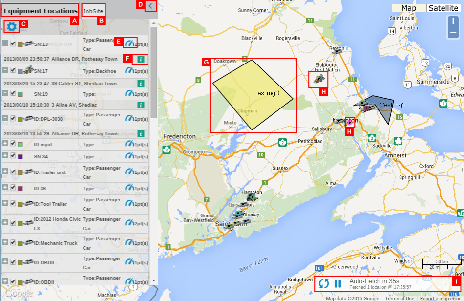
When the map is invoked you will notice that a new browser tab is opened and the title of the map page indicates the number of the fleet.
- A. Equipment Locations Tab
- ..
- B. JobSite Tab
- ..
- C
- Tracking Options Setting: ..
- D. Hide/Show Data Panel button
- This button will force the map's data panel to hide. Once hidden a second click will restore the panel to its original state.
- E. Dashboard Icon
- By clicking this icon, you can open an equipment management page.
- F. Equipment Information
- By hovering mouse over this icon, you can see various information of the equipment at that event time as below.
- G. JobSite Area
- ..
- H. Equipment
- ..
- I. Auto-Fetch Controls
- By default, when the map is invoked for last known locations (versus historical locations) it will continue to load new points as they become available to the system. The map will check for new points every 60 seconds or instantly upon clicking the refresh icon. Note that this does not force the device to send a new GPS location, it simply checks the database to see if a new point has arrived. The pause button may be used to stop the 60 second auto fetch. Once paused (the pause button changes to a play button) another click will resume fetching for new points every 60 seconds.
- J. Map/Satelite
- K. Zoom
- ...
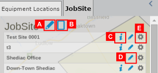
- A. Region Type Options Setting
- ...
- B. Create New Region
- ...
- C. Get Equipment in the job site
- ..
- D. Edit Region
- ..
- E
- Region Options Setting:..

